Related Articles

Learning Objectives
After completing this topic “Petroleum Geophysics“, you will be able to:
- Identify geophysics from a historical perspective
- Describe the evolutionary role of the geophysicist
- Summarize the progress and utilization of seismic technology
- Explain how to find hydrocarbon accumulations
History of Petroleum Geophysics
Only in the 19th century did geophysics develop as a distinct field from the junction of physical geography, geology, astronomy, meteorology, and physics. Many geophysical phenomena, such as the Earth’s magnetic field and earthquakes, have, nevertheless, been studied from the beginning of time.
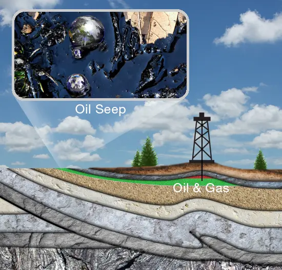
Prior to the use of geophysical techniques to search for potential hydrocarbon accumulations, prospectors relied heavily on oil seeps, or oil that has escaped to the earth’s surface (Figure 1). They also relied on the topographic nature of the earth’s surface seeking areas that were higher in elevation, such as mounds or hills. These areas were thought to potentially be an anticline a convex structure capable of trapping oil and gas.
During the mid-19th century, oil seeps in Pennsylvania led to one of the first subsurface drilling discoveries known as the Drake Well. Once a commercial use for this oil was established, an alternative to whale oil as a lighting source, the oil boom began.
Seismograph
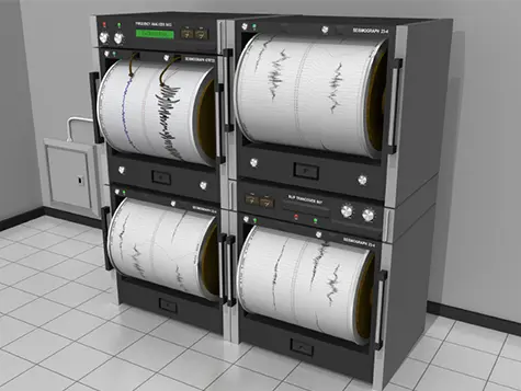
In 1855, L. Palmyra developed the first seismograph (Figure 2). A seismograph is an instrument that detects and records earthquakes. This device is able to detect and record the vibrations of the earth that occur during an earthquake. The seismograph was used in World War I to find the location of enemy guns. However, it was not until 1921 that this technology was applied to the oil and natural gas industry to help locate underground reservoirs.
In 1919, a German scientist named Ludger Mintrop measured the distance from an explosion to a seismograph. Mintrop found that he could estimate subsurface geological features based on the time it took the elastic earth wave to travel from the explosion shotpoint through the subsurface, to seismic detectors -geophones-located about two miles away. During this experiment, variations in time confirmed the existence of salt domes that transmitted the elastic earth waves at a higher speed.
Mintrop’s Method
After World War I, Mintrop’s seismograph prompted individual development and patent applications for seismograph use in geology. One group of developers was headed by John C Karcher from Oklahoma and the other was a German Company, Seismos Gesellschaft.
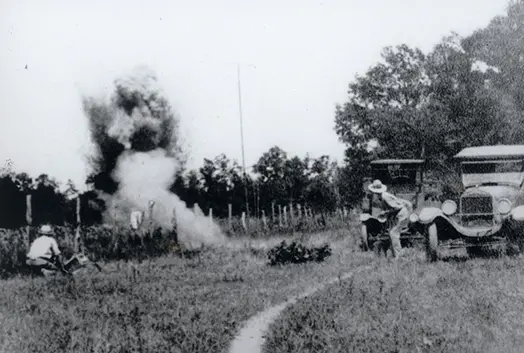
On June 4, 1921 Karcher led his team to test their seismograph on a farm three miles north of Oklahoma City (Figure 3). The test, known as Belle Isle, determined that the subsurface structure was capable of retaining oil.
Shortly after the Belle Isle test, Karcher helped form The Geophysical Research Corporation (GRC), a division of DeGolyer’s Amerada Petroleum Corporation. In 1926, GRC sent a reflection seismograph crew into the field near Seminole, Oklahoma, to map subsurface structures. After locating a subsurface structure deemed likely to bear oil, Amerada drilled and struck oil. This was the world’s first successfully drilled oil well discovered through the use of reflection seismography.

From 1923 to 1925 Seismos Gesellschaft led their seismic prospecting in East Texas and in the Texas Gulf Coast, where they were employed by Gulf Oil (Figure 4). During 1924 this team was responsible for the first seismic discovery of a salt dome along the Texas coast at a location known as the Orchard Dome in Fort Bend County. The discovery of this salt dome may have been the first seismic discovery of a salt dome that produced oil in the world.
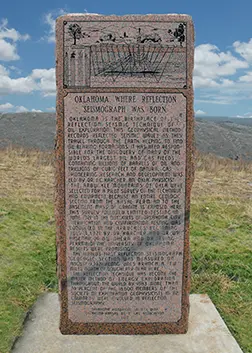
On April 1, 1971 the Midwestern Society of Exploration Geophysicists met in Oklahoma City where it was determined that a monument was to be erected for Karcher’s 1921 test at Belle Isle. The inscription of the Belle Isle monument reads, in part: “Birthplace of the Reflection Seismograph. Field tests which confirmed the validity of the reflection seismography method of prospecting for oil were conducted near this spot on June 4, 1921. The shot has virtually echoed around the world.”
Advanced Uses of Seismographs
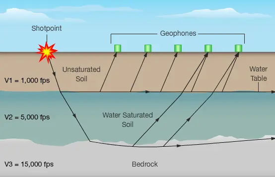
The first successful seismographs utilized a method known as refraction seismology. Refraction seismology allowed development and commercial implementation of another seismic method known as reflection seismology. Both seismology methods rely on the understanding that different rock types allow different velocities of waves to travel through them. The boundaries between those differing rock types are what the refraction and reflection methods detect, thus rendering an image of the subsurface.
Seismology Methods
Refraction
The refraction method uses seismic wave deflection of geological layers of soil and rock to depict the subsurface geological conditions of a geological structure (Figure 5).
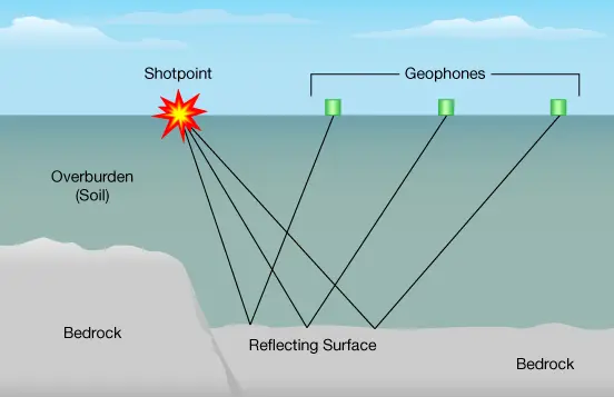
Reflection
The reflection method reflects sound to the surface through the use of echo sound waves that reflect from subsurface geological structures (Figure 6).